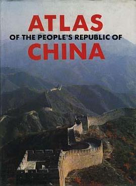

The Atlas of the People's Republic of
China is the first English-language atlas
of the country ever published in China
since the founding of the People's Re-
public in 1949. The maps are organized
by administrative divisions and topogra-
phy. In the first category, four regions of
strategic importance and great economic
value are mapped in addition to all
the provinces, autonomous regions and
municipalities directly under the Central
Govemment, which are the first level of
administrative divisions under the state.
The four geographical rather than ad-
ministrative regions are the Shanghai-
Nanjing-Hangzhou Region south of the
last leg of the Yangtze River, the Pearl
River Delta, the South China Sea Is-
lands, and the Chengdu-Chongqing Re-
gion, the central land of the Sichuan
Basin on the middle reaches of the
Yangtze River. Accompanying each map
of an administrative division is a text
covering the following topics:
Populatioo
Urban population
Natiooalities
Area
Altitade
Coastline
Climatic features
Average temperatore
ABBUI average raiofall
Physical features
Mountains
Plateaus
Deserts
Basins
Rivers
Lakes
Products
Specialties
Administrative divisions
Capital
Neighbonog areas
Neighboring couotries
Major cities (towns)
Tourist attractions
(Continued on backflap)
(Continued from frontflap)
Also, the map of China's general topo-
graphy with a brief description produces
a clearer picture than the map does all
by itself. For the convenience of the
readers, the alphabetic order of the ad-
ministrative divisions on the provincial
level is available on the title page of
the index. The atlas includes some la-
test changes, such as the establishment
of Hainan Province in early 1988.
A comprehensive atlas of China, this
volume will be of great value to univer-
sities, libraries, and research institutes,
as wcll as individuals.
具体描述
读后感
评分
评分
评分
评分
用户评价
相关图书


本站所有内容均为互联网搜索引擎提供的公开搜索信息,本站不存储任何数据与内容,任何内容与数据均与本站无关,如有需要请联系相关搜索引擎包括但不限于百度,google,bing,sogou 等
© 2025 book.wenda123.org All Rights Reserved. 图书目录大全 版权所有