
具体描述
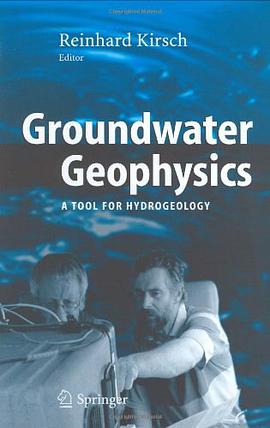
Geophysical techniques can map the underground conditions apart from boreholes. The use of these methods for hydrogeological applications is demonstrated for mapping of porous and structural aquifers, determination of groundwater quality (mineralization), assessment of hydraulic properties, determination of aquifer vulnerability and mapping of contaminated sites. Additionally, a description of geophysical techniques used for groundwater studies is given including seismics, resistivity methods, magnetics, ground penetrating radar and NMR (nuclear magnetic resonance). In this second edition new chapters on RMT (radio magnetotelluric) and on the determination of groundwater flow in monitoring wells are included.
作者简介
目录信息
读后感
评分
评分
评分
评分
用户评价
相关图书


本站所有内容均为互联网搜索引擎提供的公开搜索信息,本站不存储任何数据与内容,任何内容与数据均与本站无关,如有需要请联系相关搜索引擎包括但不限于百度,google,bing,sogou 等
© 2026 book.wenda123.org All Rights Reserved. 图书目录大全 版权所有