
具体描述
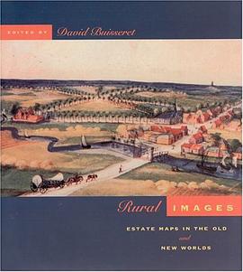
Just when private property materialized as an important social institution, a new kind of map appeared - the estate map. Prepared for private owners rather than national powers, these maps have been a little-studied strain of cadastral mapping until now. In this book, a group of leading historians - Sarah Bendall, David Buisseret, P.D.A. Harvey and B.W. Higman - follow the spread of estate maps from their origin in England around 1570 to colonial America, the British Caribbean and early modern Europe. Illustrated with reproductions of rare manuscripts, including 8 colour plates, these accounts reveal how estate maps performed vital economic and cultural functions for property owners until the end of the 19th century. From plans of plantations in Jamaica and South Carolina to a map of Queens College, Cambridge, examples show that estate maps formed an important part of the historical record of property ownership for both individuals and corporations, and helped owners manage their land and appraise its value. Exhibited in public places for pleasure and as symbols of wealth, they often displayed elaborate cartouches and elegant coats-of-arms. David Buisseret is the author of "Historic Illinois from the Air" and editor of "Monarchs, Ministers, and Maps" and "From Seas Charts to Satellite Images: Interpreting North American History through Maps", all published by the University of Chicago Press.
作者简介
目录信息
读后感
评分
评分
评分
评分
用户评价
相关图书


本站所有内容均为互联网搜索引擎提供的公开搜索信息,本站不存储任何数据与内容,任何内容与数据均与本站无关,如有需要请联系相关搜索引擎包括但不限于百度,google,bing,sogou 等
© 2026 book.wenda123.org All Rights Reserved. 图书目录大全 版权所有